Outdated Apps
Predicts general activity across an entire area, useless if you’re in the wrong stand.
DeerMapper
Predicts exact arrival time and direction of approach for every specific stand.
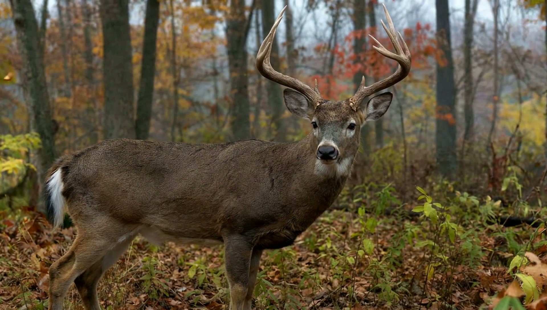
New Generation Hunting App
Your trail cam photos hold a hidden story. We’re data scientists, and we decoded it. Photos become patterns. Patterns predict your hunt.
Probability 94% · High confidence
What is DeerMapper?
DeerMapper is an AI-powered deer hunting intelligence and analytics platform that uses a hunter’s own trail-camera and property data to identify patterns and provide personalized deer movement insights and predictions.
Instead of regional averages or generic moon-phase charts, DeerMapper analyzes what has actually happened on your land, stand by stand, and tells you when and where a specific deer is most likely to show up next. It works on iOS and on the web, with a desktop companion for deeper analysis.
Connect your trail-camera SD card to your phone with the included DeerMapper Adapter, pick the camera or location, and tap Start. DeerMapper finds only the new photos and files them into the right camera history, so cameras from across your property, even different brands, build one record instead of staying scattered. Season after season, that record deepens: year-over-year events pulled from your own photos let DeerMapper tell you the story of your deer and sharpen every hunt that follows.
What Makes DeerMapper Different
Every prediction, every pattern, and every insight is built entirely from the deer movement on your land. Not someone’s weather forecast. Not regional averages. Yours.
Them vs. Us
Outdated apps guess. DeerMapper learns from your deer, your stands, and your wind, so every recommendation is rooted in real movement from your land.
Predicts general activity across an entire area, useless if you’re in the wrong stand.
Predicts exact arrival time and direction of approach for every specific stand.
AI-tags deer with no location context. Just photos in a pile.
Builds a complete intelligence record, every sighting tied to the stand it came from.
A scrape or map pin without a camera is a blind guess.
Every map pin carries location-specific photo data. Nothing is speculation.
Charts generic weather and moon phases, do you really trust the weather?
Uses empirical, real-world deer movement data from your actual land.
Tracks the camera. Swap a camera and your history disappears.
Tracks the stand. Your intelligence survives across decades of cameras.
How It Works
We do the data mining. You do the hunting. The AI gets smarter with every photo.
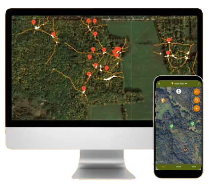
Walk your ground.
Log deer trails, navigate to stands, set camera directions, and import right at the camera. Connect. Select. Start.
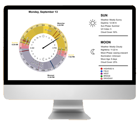
Data-mine every photo.
DeerMapper finds only the new photos, keeps their capture date and time, and files them to the camera you picked. No sorting. No labeling.
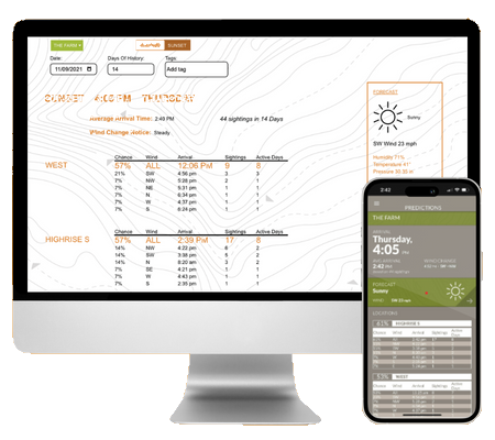
Know the arrival.
Stand, time, wind, direction, predictions built from your deer’s actual history, not regional averages.
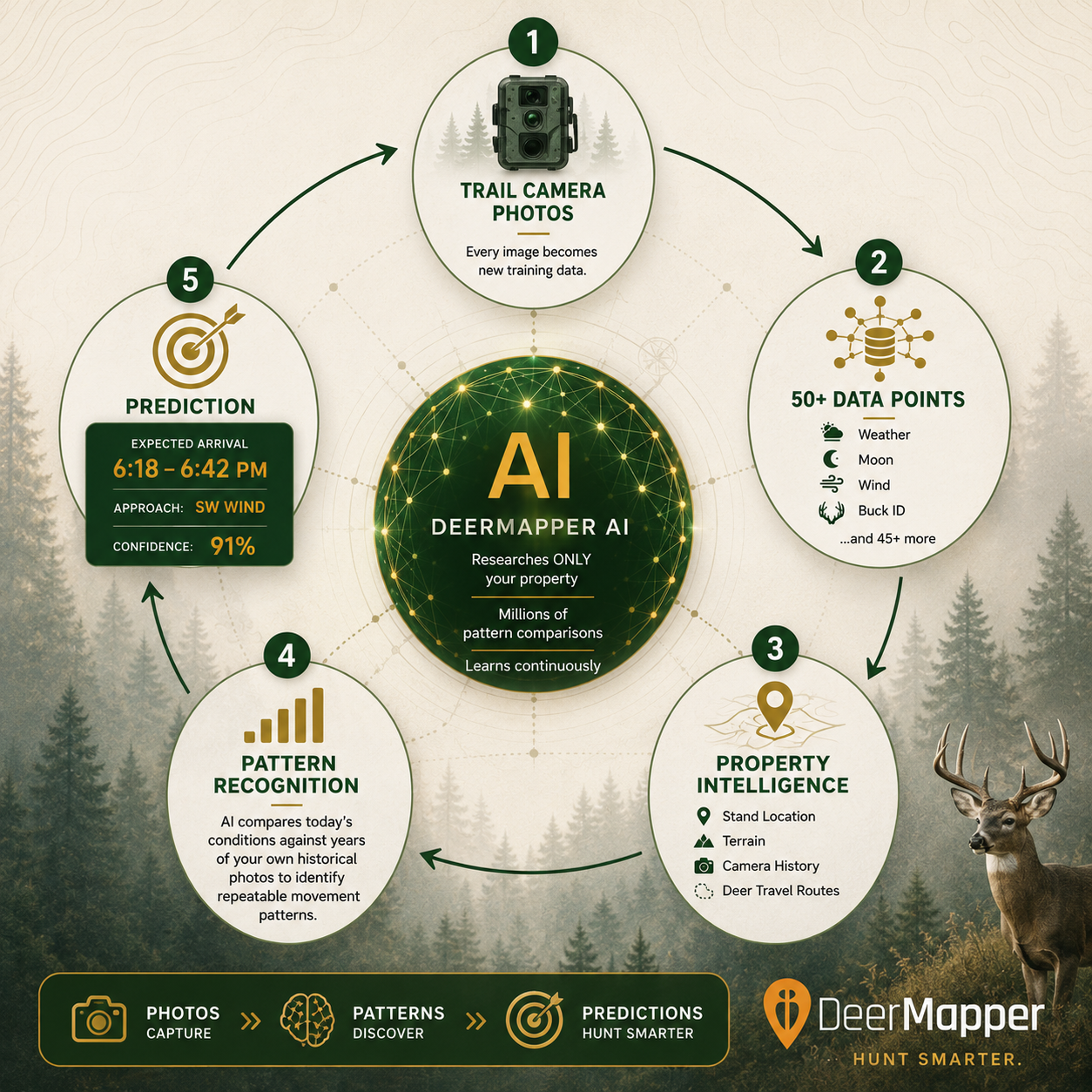
The system evolves.
Every photo you import sharpens the model. Year over year, your own trail-cam history reveals deeper patterns and better hunts.
Learn more about our technologyPin every trail, stand, food source and rub. The only app that maps all 7 patented location types, the foundation of every prediction.
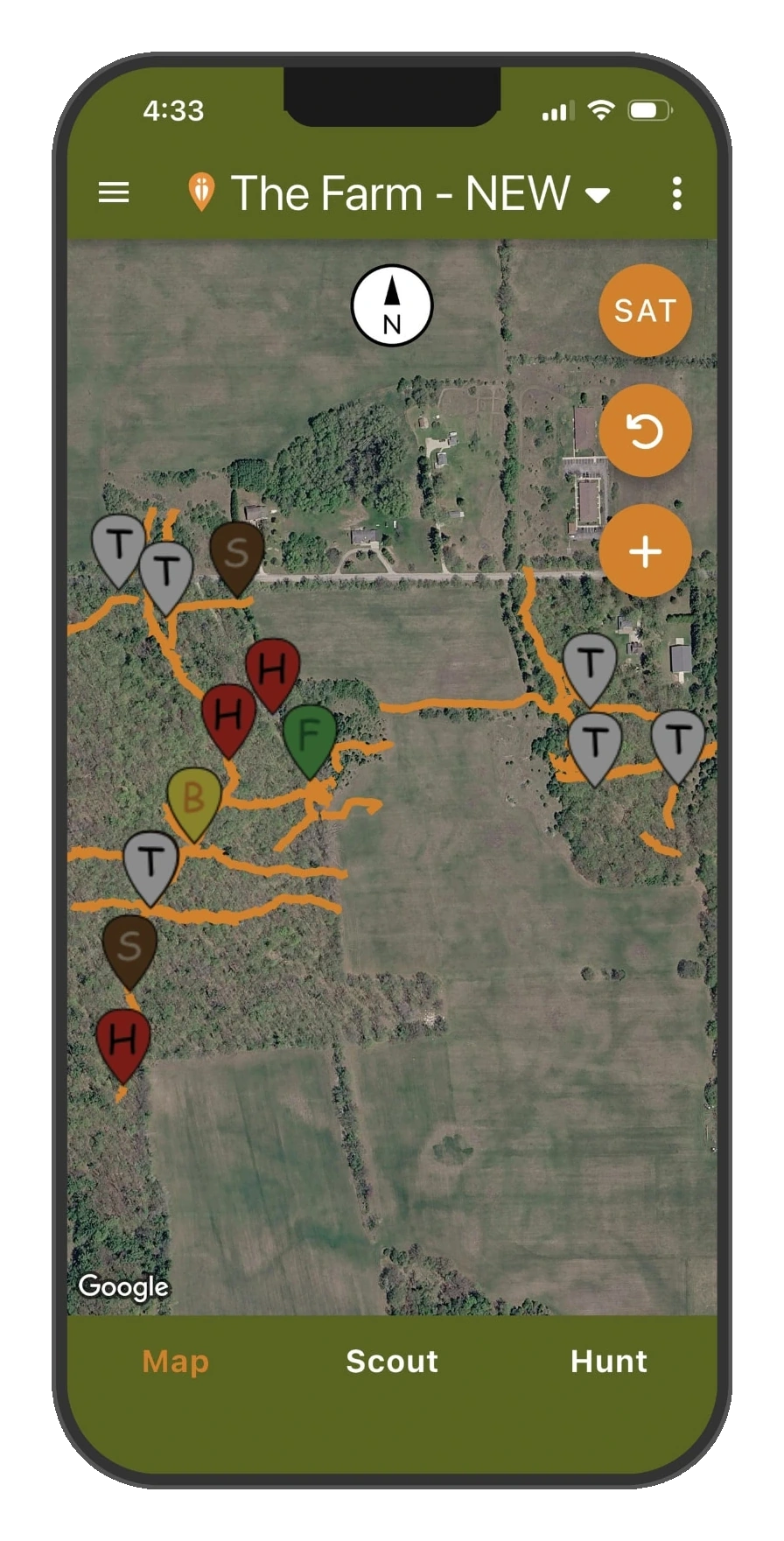
Your entire property at a glance, every stand, hub, food source and trail in one view.
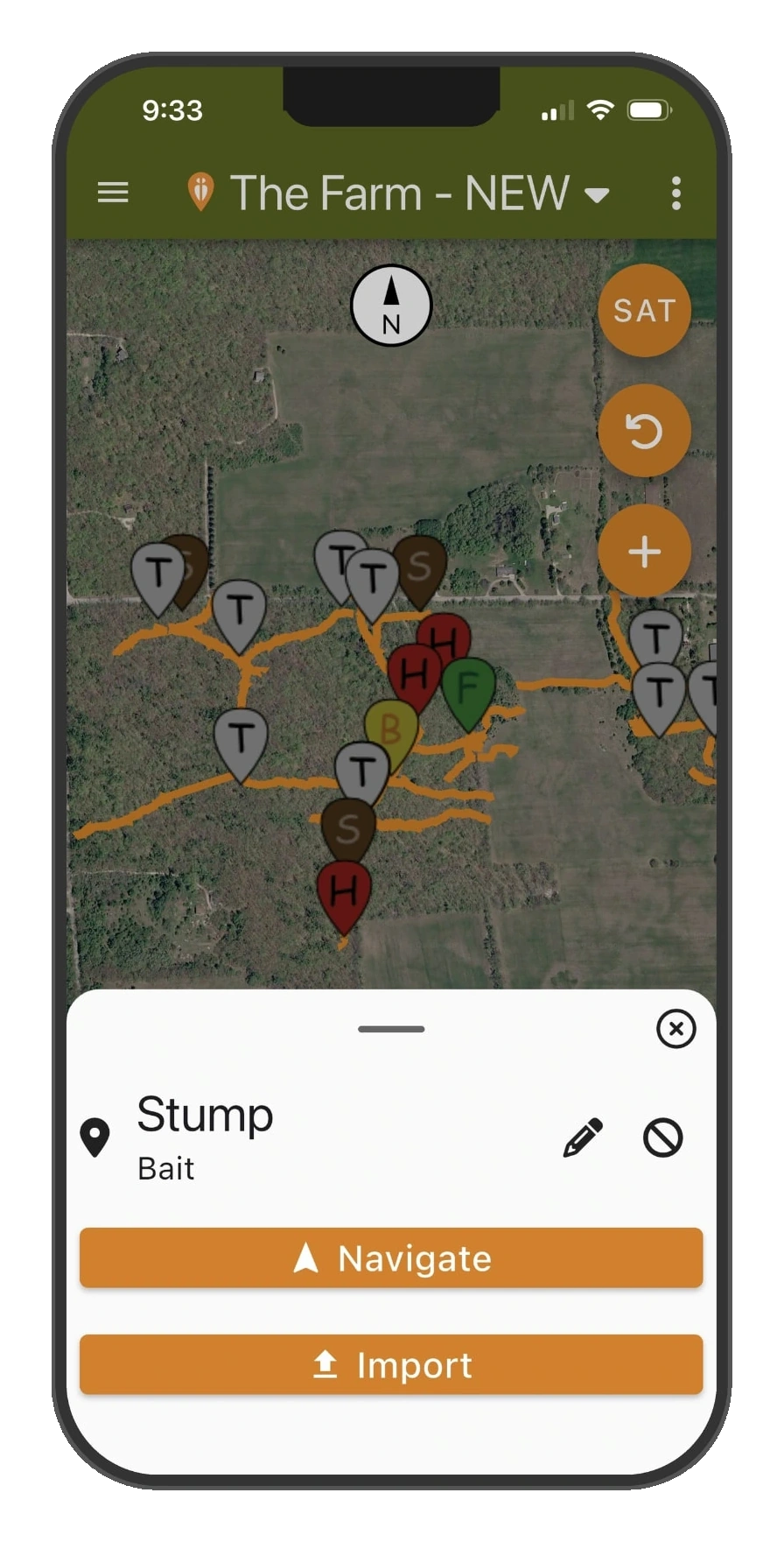
Tap any pin for the full story, then navigate to it or import new photos right at the camera.
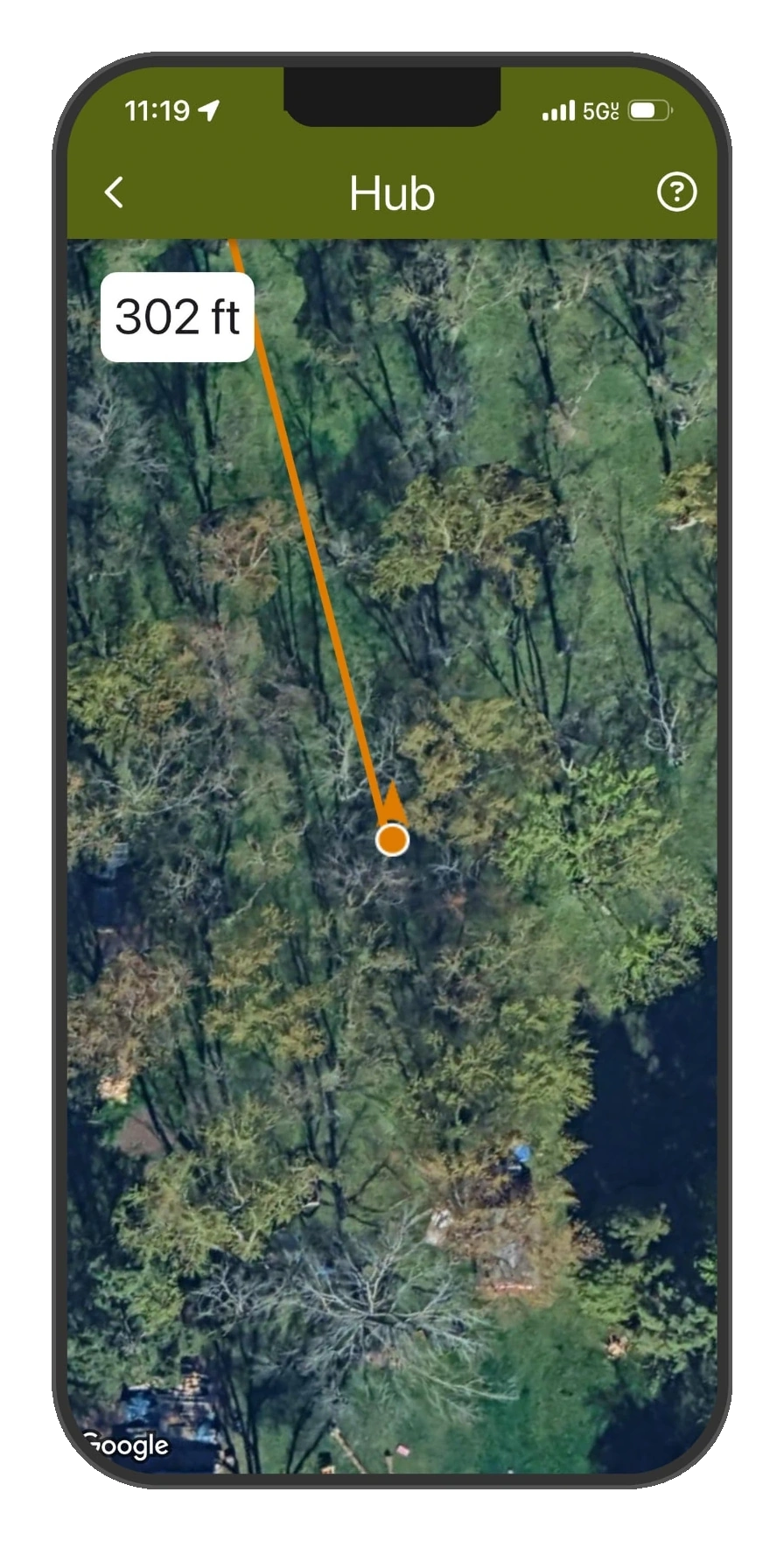
Live distance counts down as you walk straight to your hub.
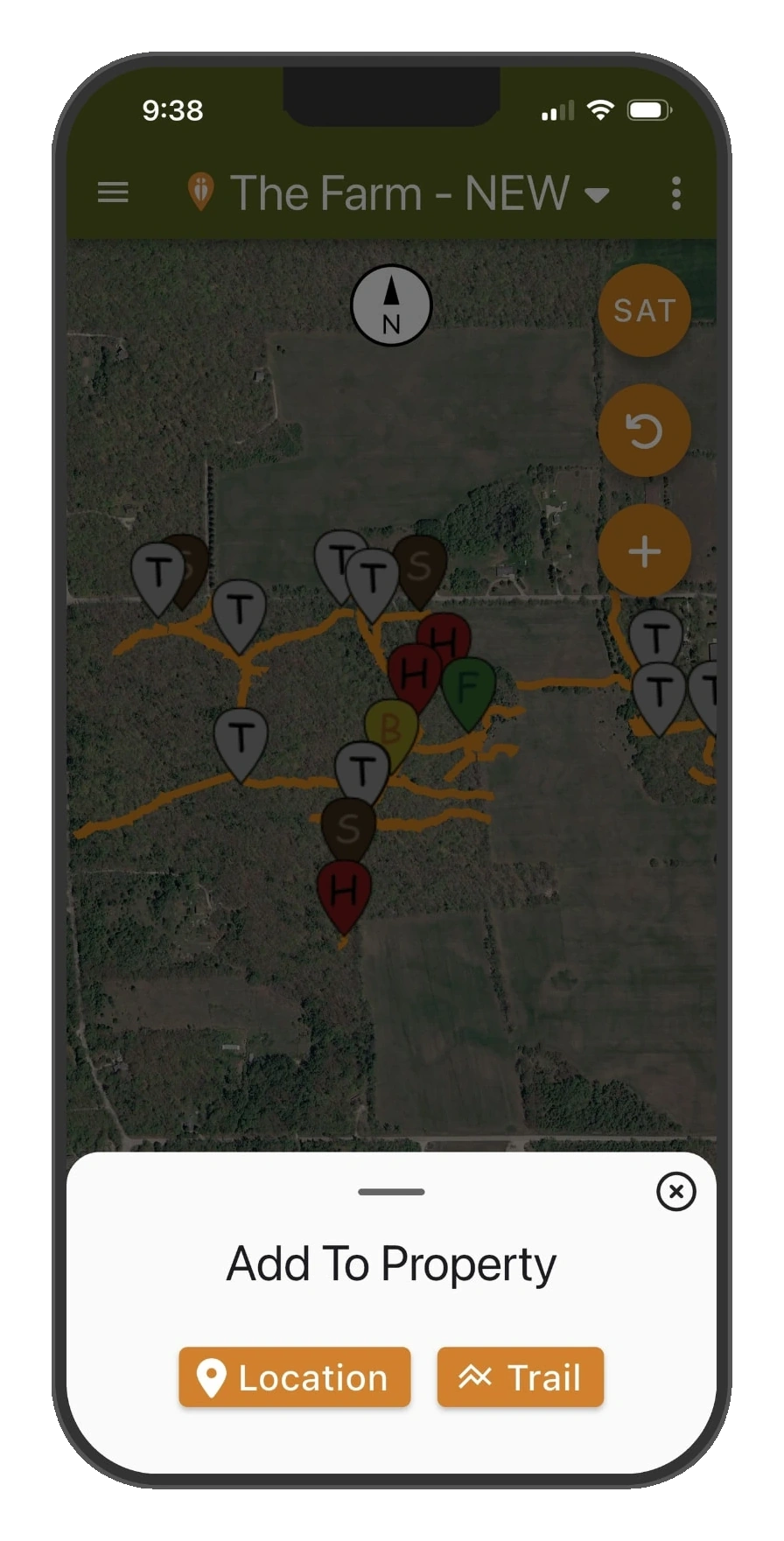
Add to your property right where you stand, drop a location or start a trail.
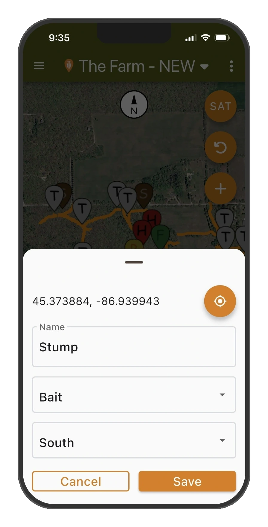
Name it, pick the type, set the wind, a new pin saved in seconds.
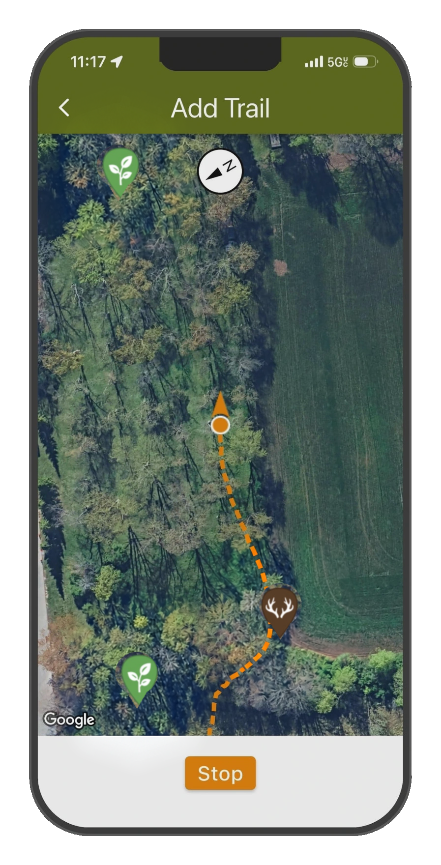
Record trails as you walk them, hit Stop and it's on the map for good.
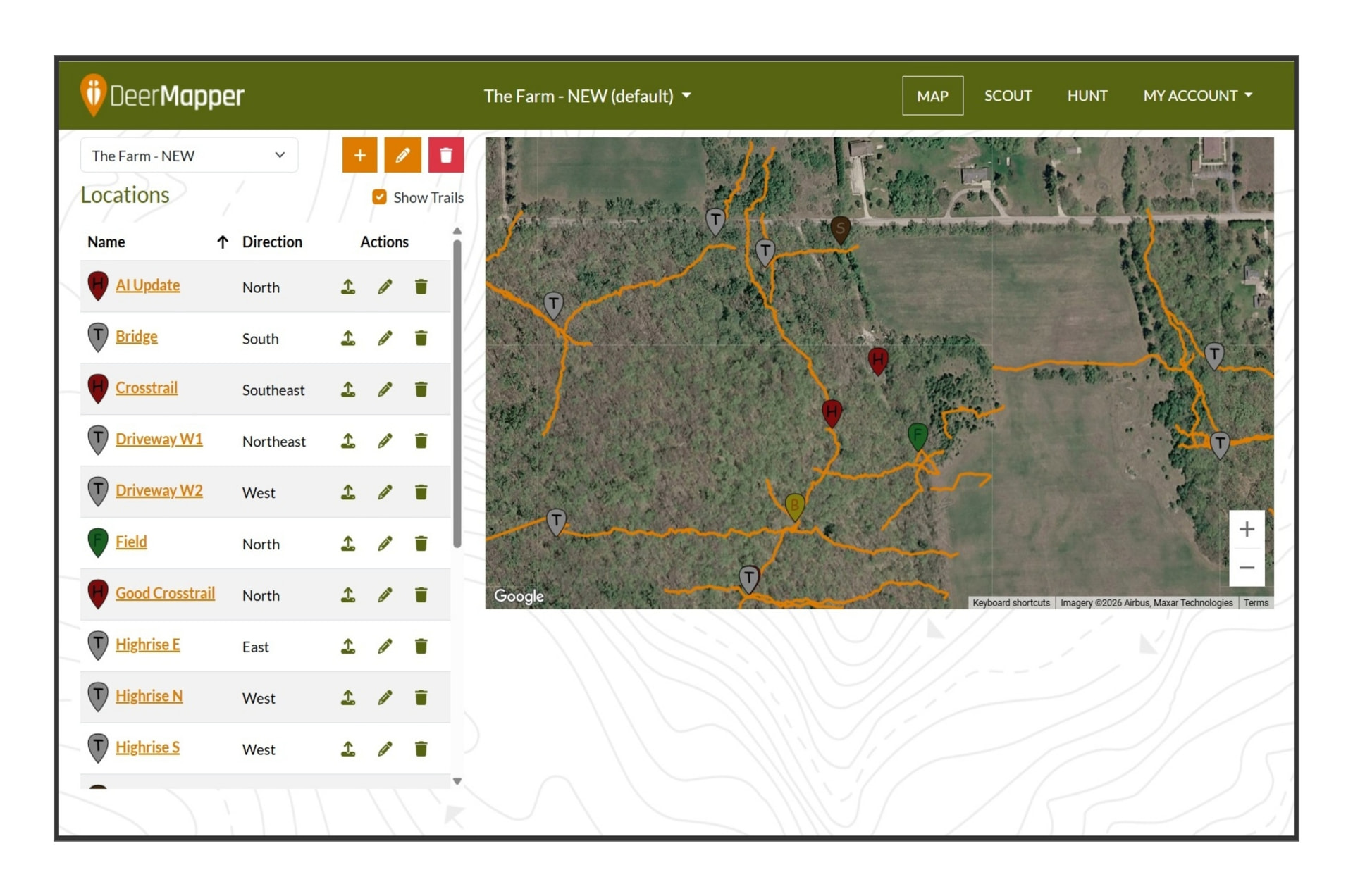
The web dashboard mirrors your phone, review and manage every location from your desk.
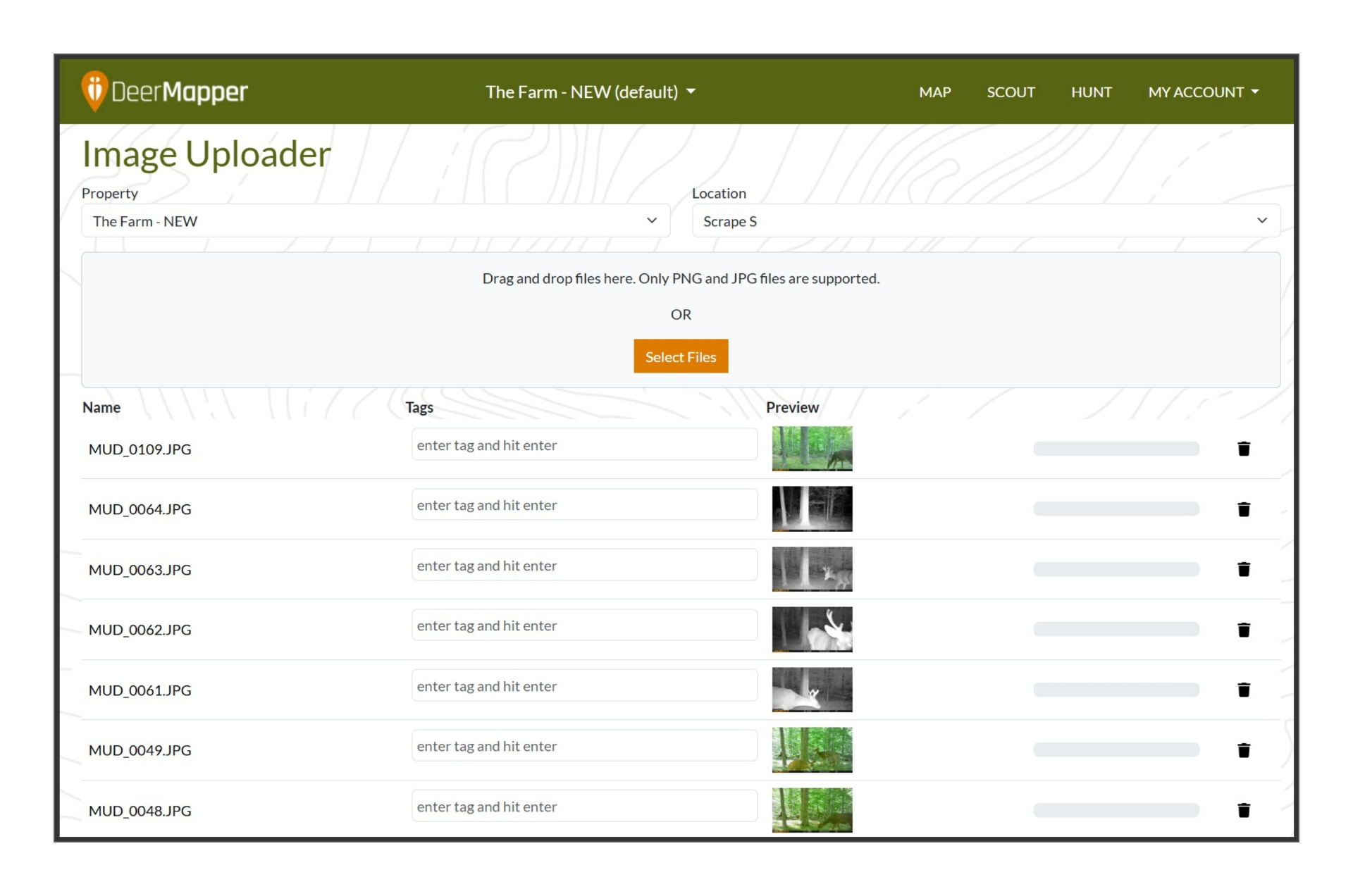
Bulk-import trail cam photos and tag each one to the pin it belongs to.
Arrival directions, wind-filtered history, deer clocks and pattern maps, built entirely from your herd's movements, not regional averages.
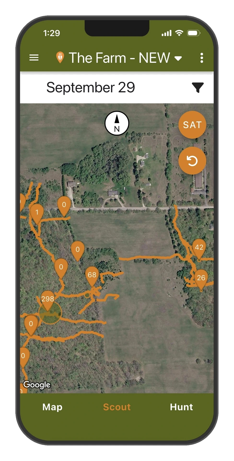
Scout map stacks live deer counts over every stand and trail on your land.
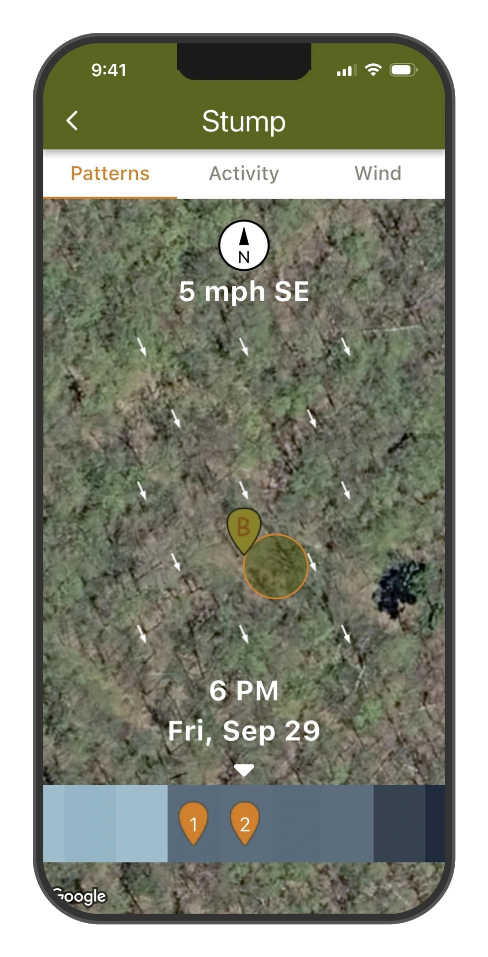
Patterns replay deer movement hour-by-hour with live wind arrows.
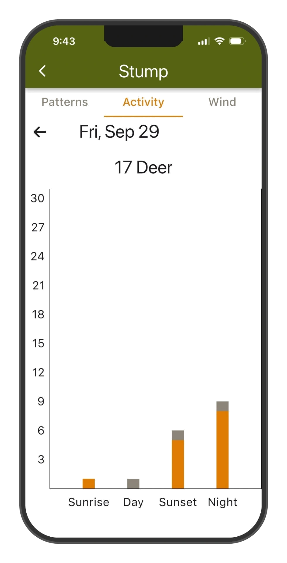
Activity charts break each day down by sunrise, day, sunset and night.
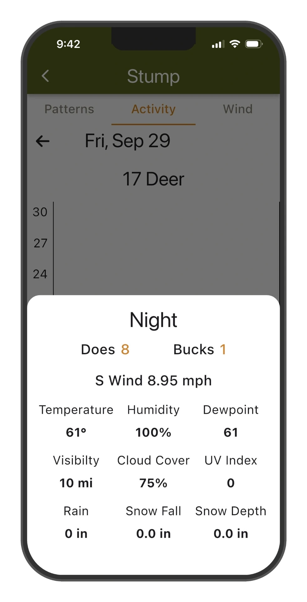
Tap any bar for the full story, deer counts plus every weather condition.
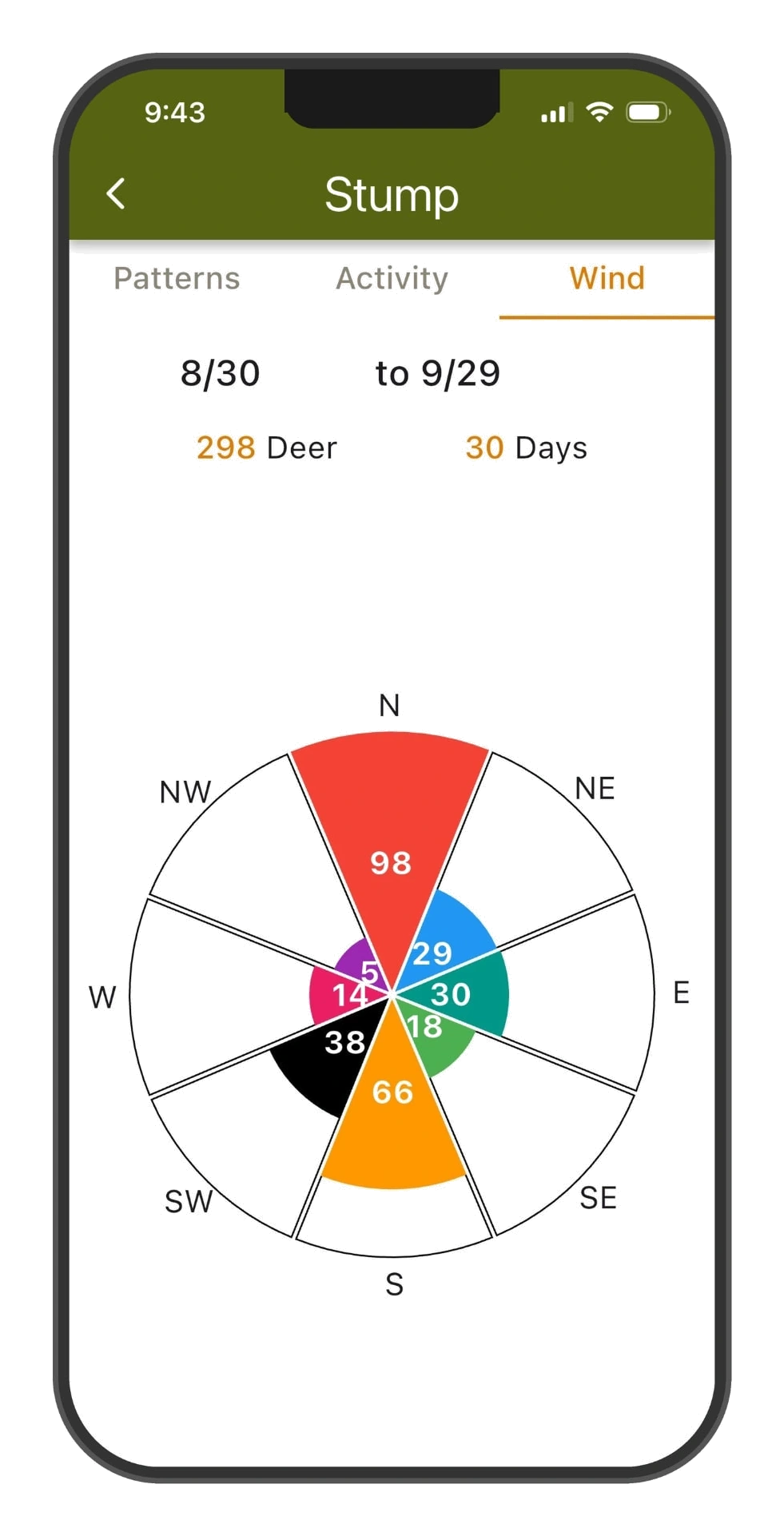
The wind rose shows exactly which winds move deer at each stand.
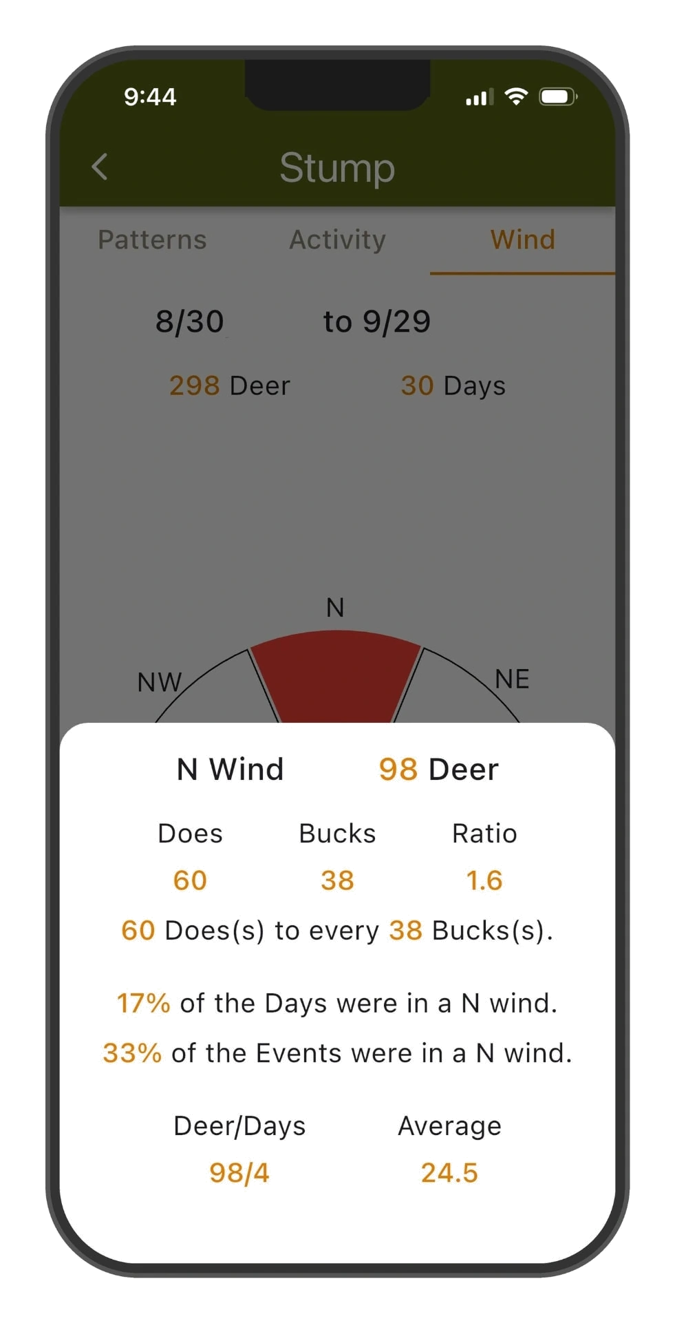
Drill into any direction, deer counts, buck-to-doe ratio and daily averages.
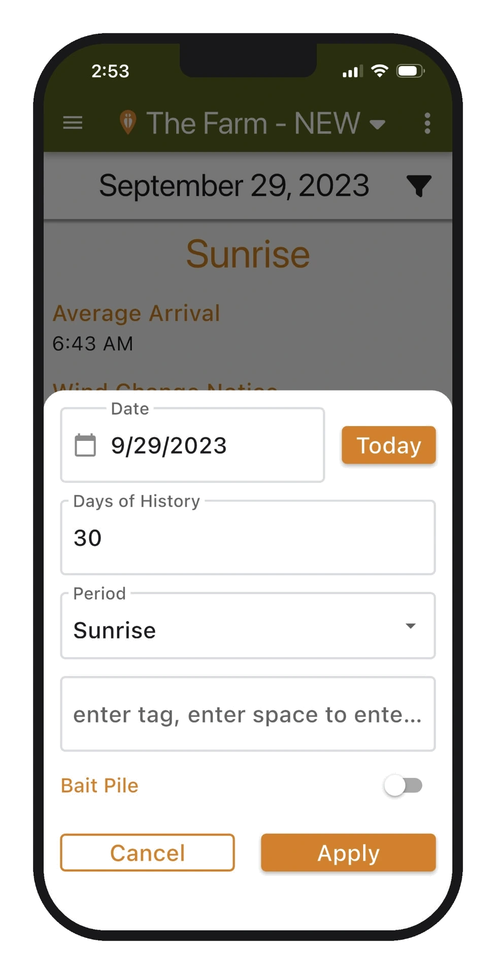
Filter everything by date, period or tags, even bait-pile-only history.
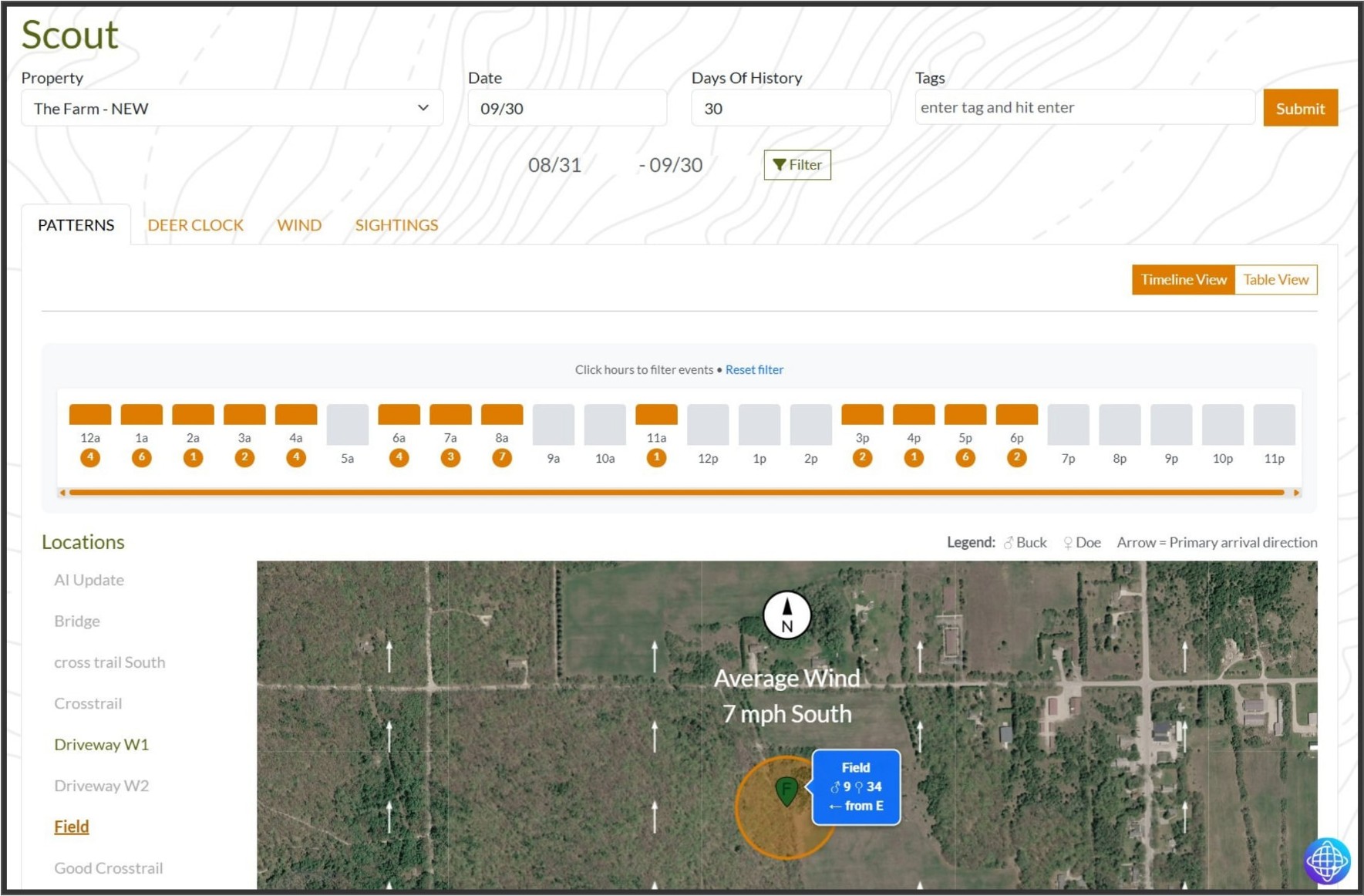
Patterns on the big screen, hourly activity timeline over a live map with arrival arrows.
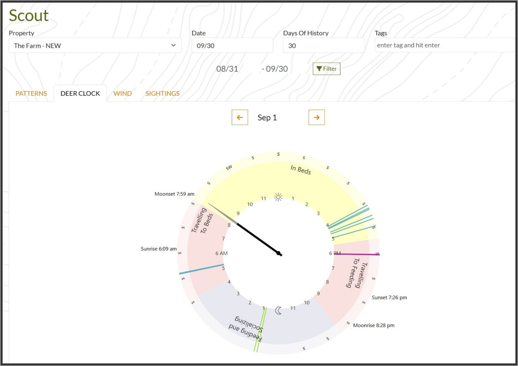
The deer clock maps beds, travel and feeding against sunrise, sunset and moon phases.
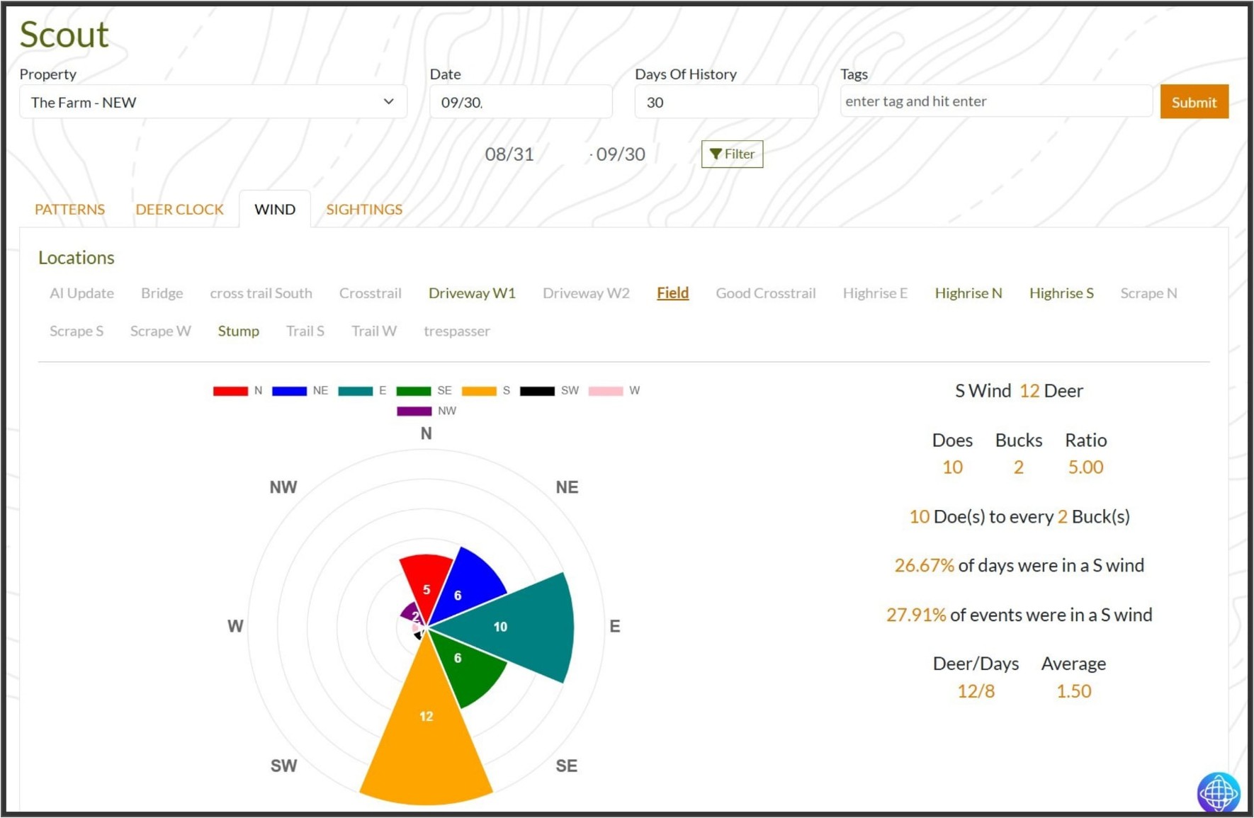
Wind analysis for every stand, deer counts, buck-to-doe ratio and daily averages.
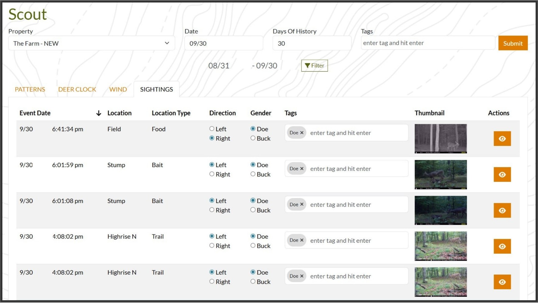
Every sighting in one table, review trail cam photos and tag each event in seconds.
Ranked stand predictions for today's wind, sit-timing tables and turn-by-turn navigation, so you're in position before shooting light.
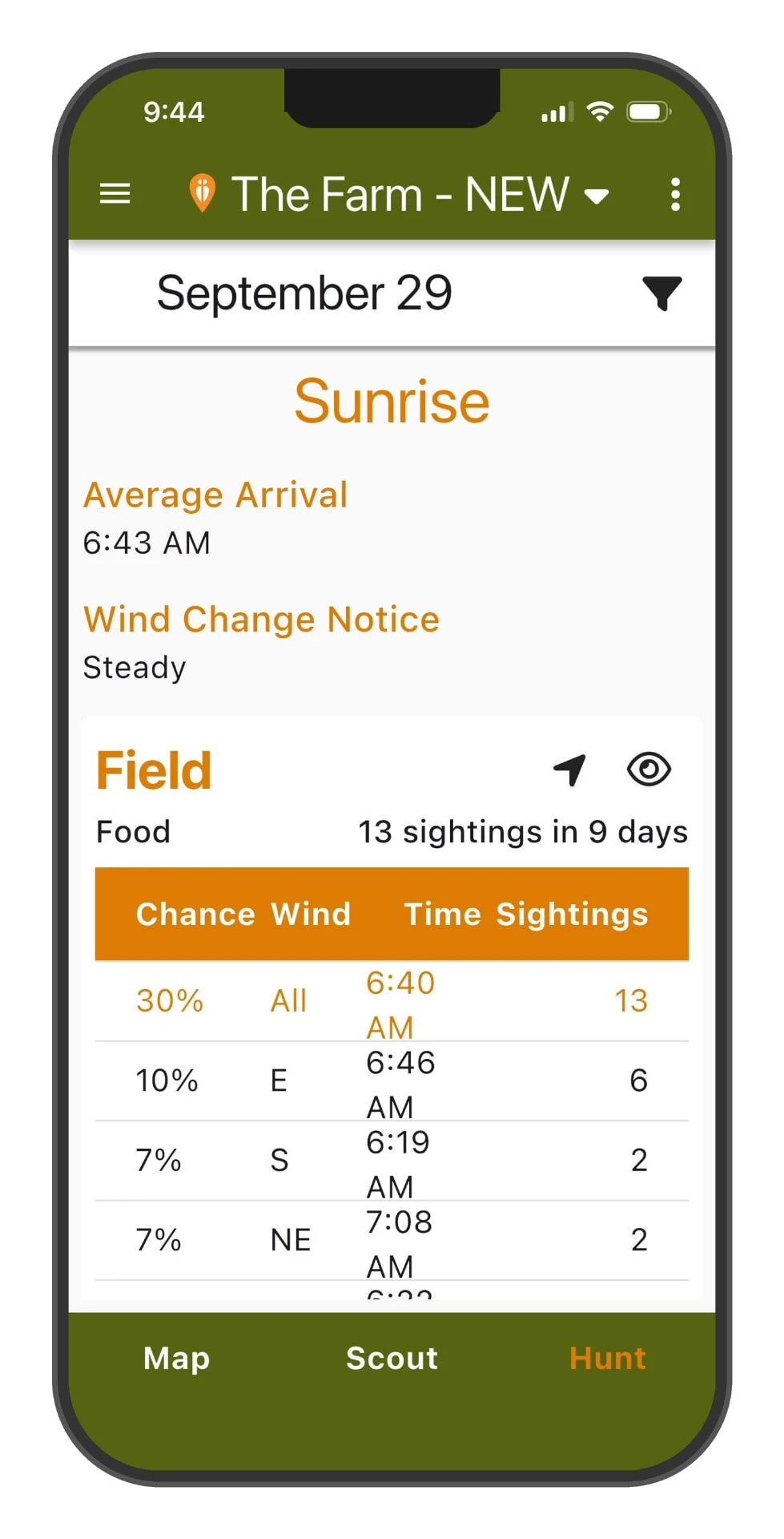
Sunrise predictions per stand, chance, wind, arrival time and sightings at a glance.
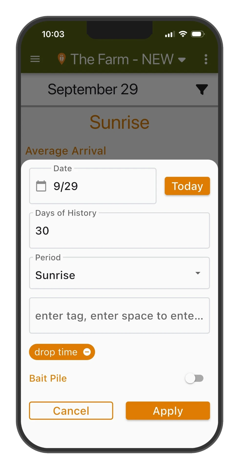
Filter predictions by date, days of history, period and tags, even bait-pile-only.
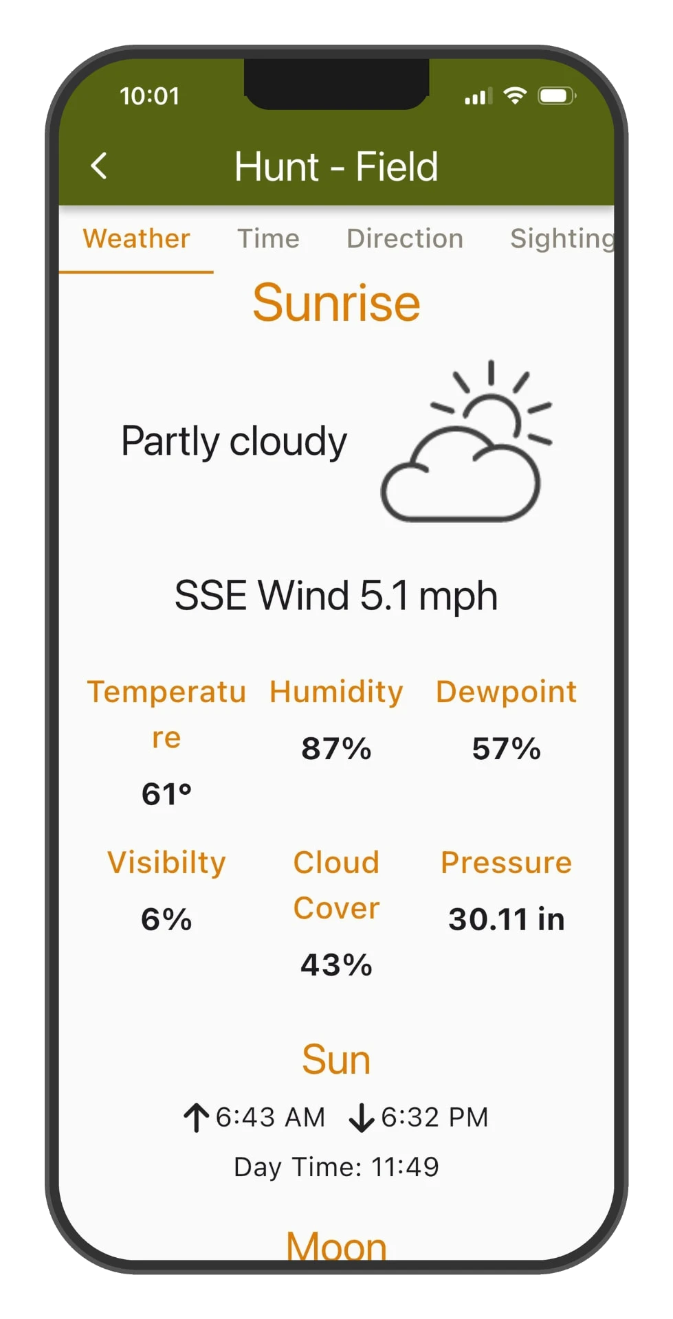
Hunt-day weather for your stand, wind, humidity, pressure and sun times.
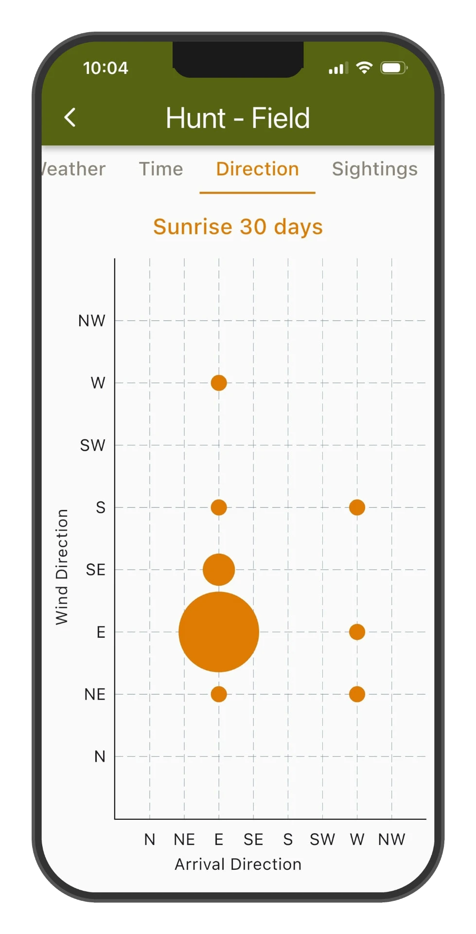
Wind vs arrival direction, see exactly where deer come from on every wind.
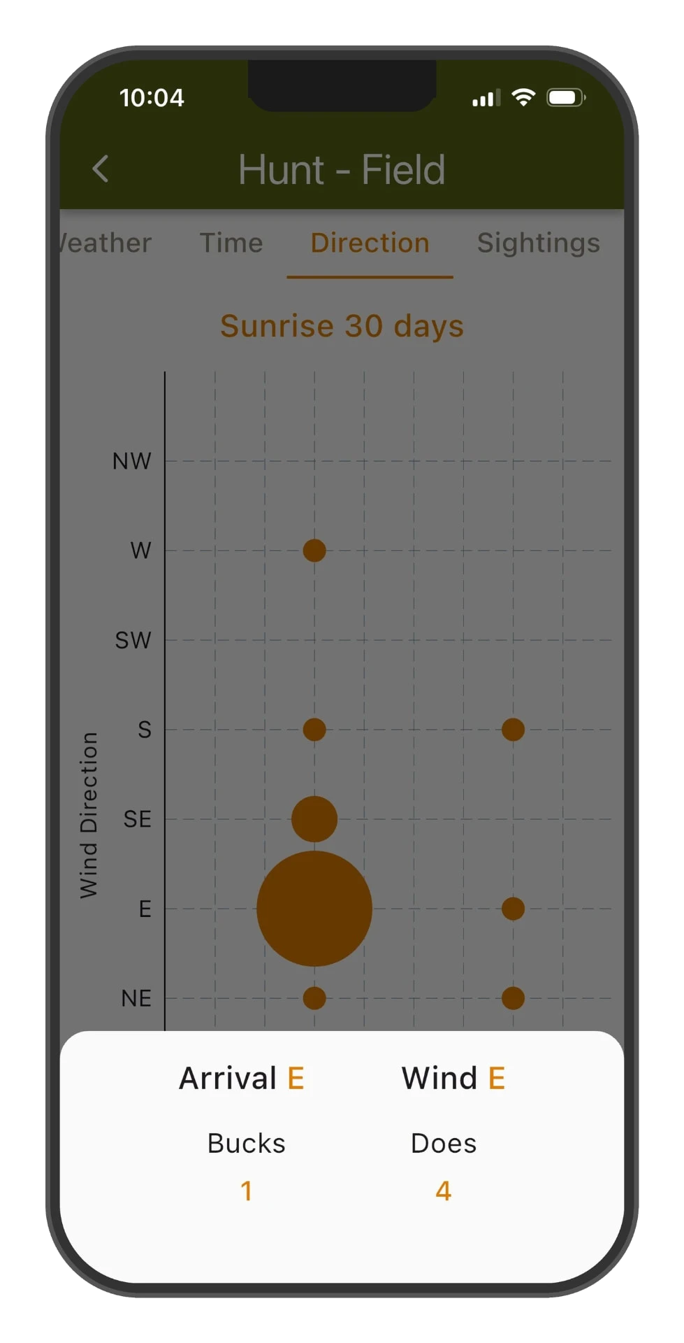
Tap any bubble for the buck-to-doe breakdown on that wind and arrival.
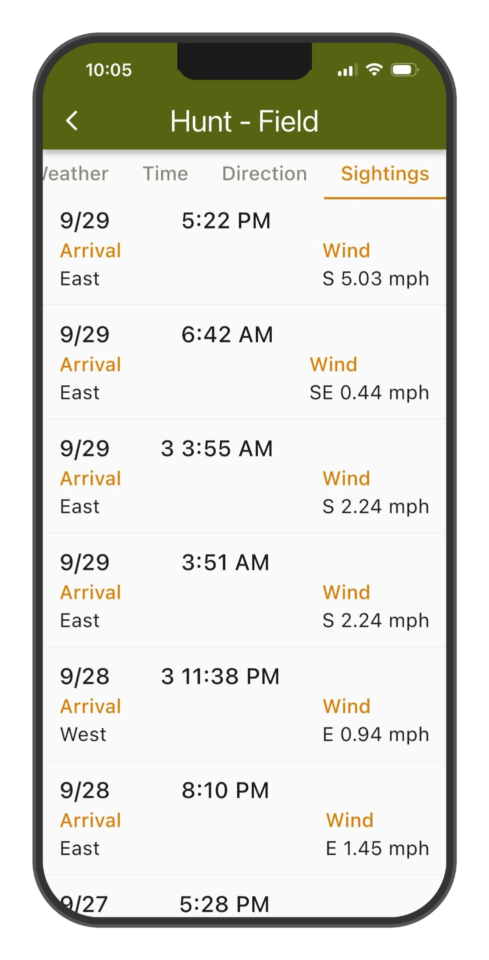
Full sighting history per stand, arrival direction and wind for every event.
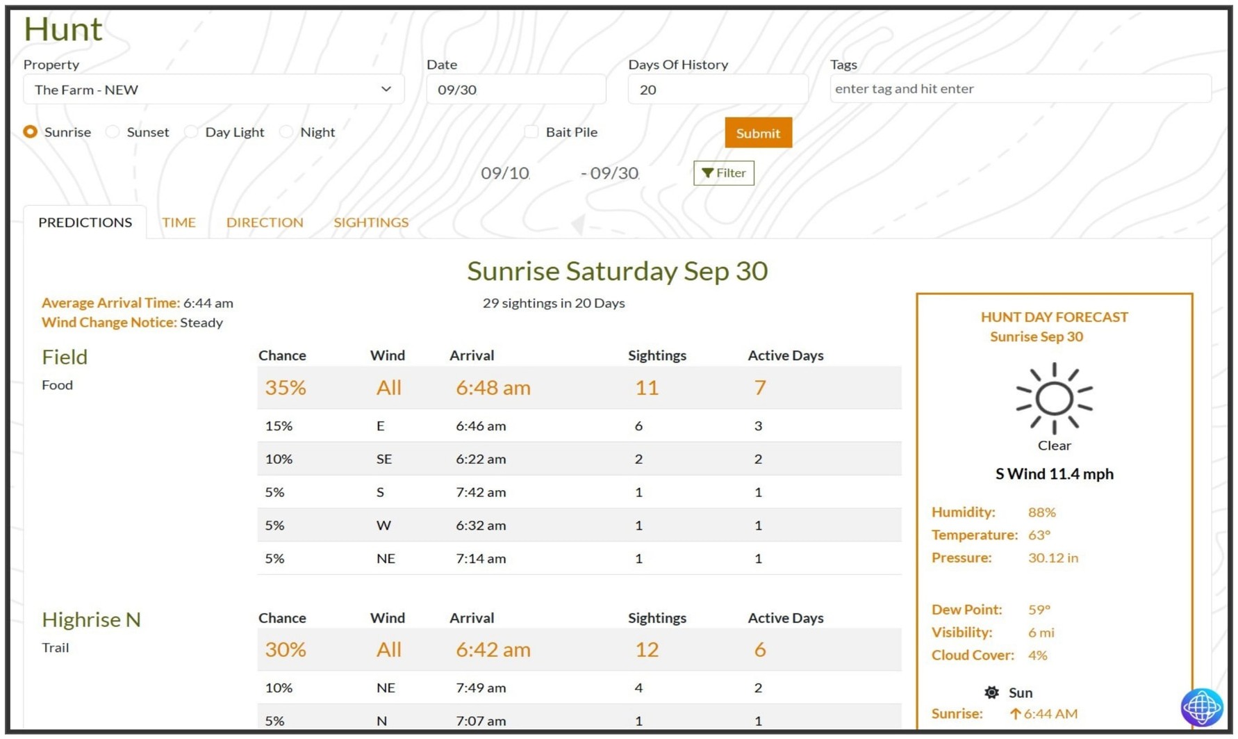
Ranked stand predictions on the big screen, with the hunt-day forecast alongside.
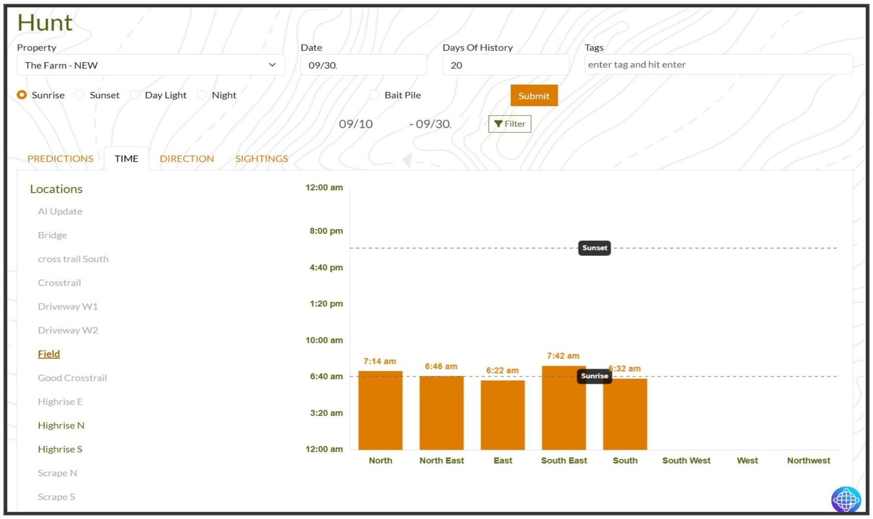
Arrival times charted by wind direction against sunrise and sunset.
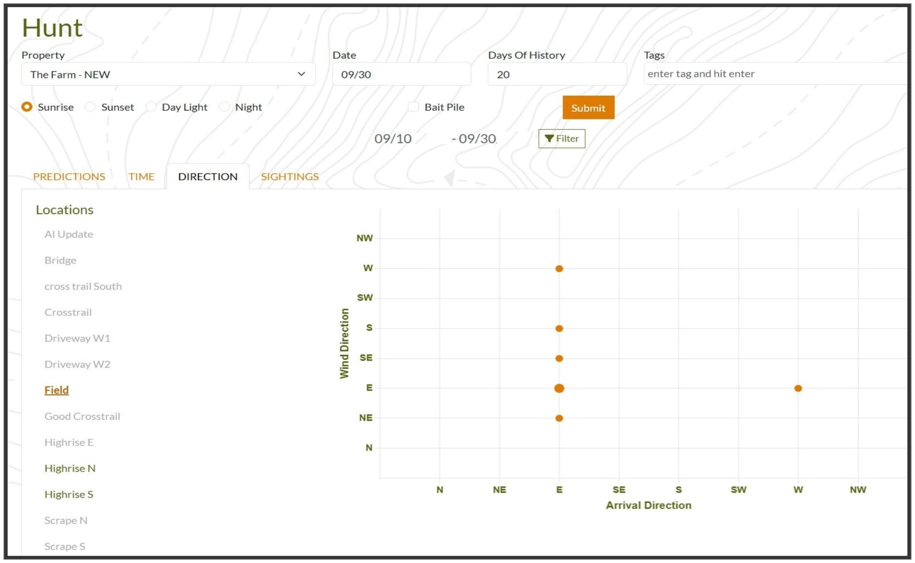
The wind-vs-arrival matrix, spot which winds move deer past each stand.
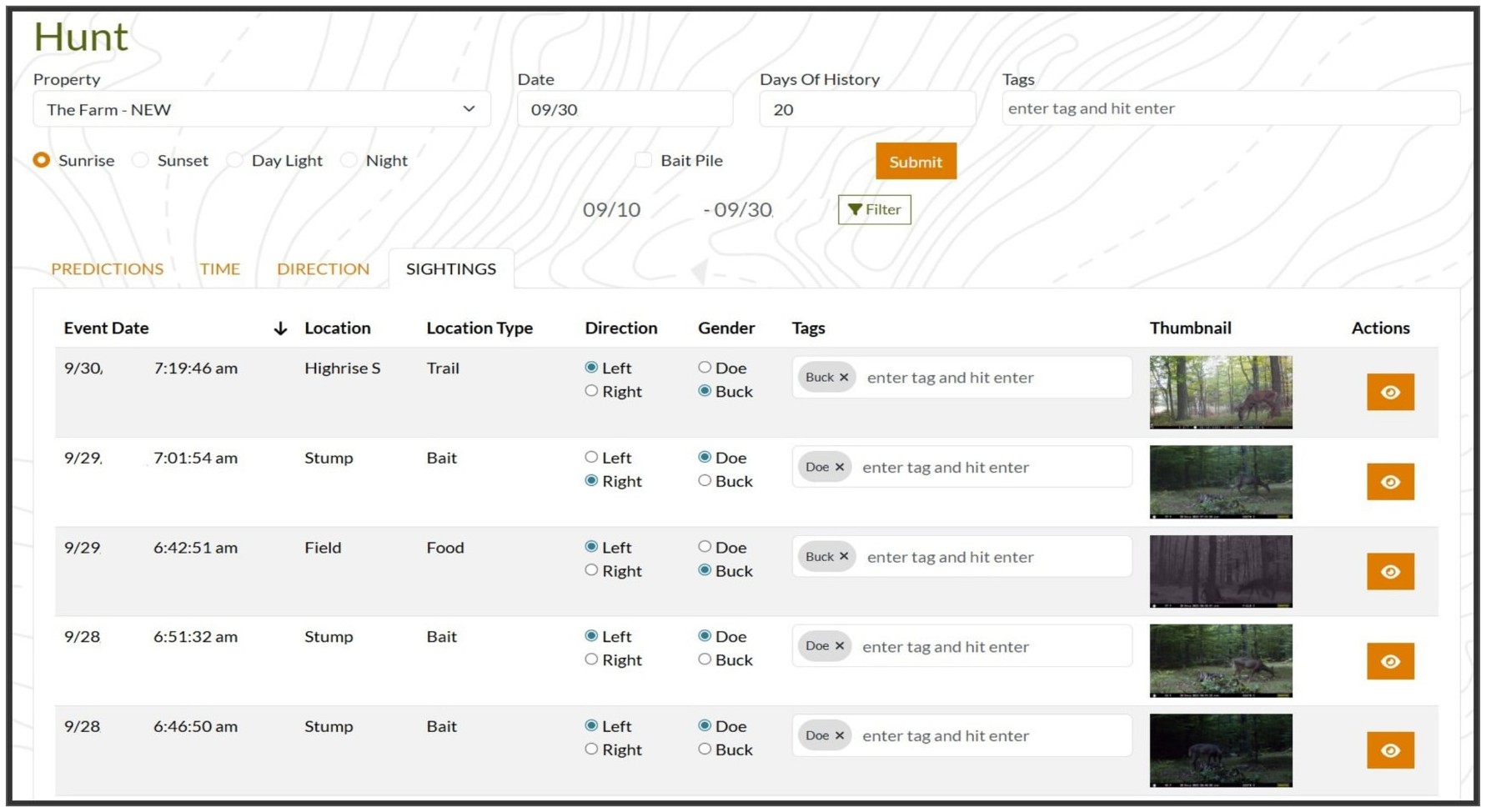
Every sighting in one table, review trail cam photos and tag each event.
Early Tester
“I’ve hunted the same 200 acres for twelve seasons and thought I knew every trail. After two weeks running my cams through DeerMapper, it called an evening window I would’ve slept through, and a 9-point walked by at 6:42 pm, six minutes off the prediction. Excited to see what ends up on my trophy wall this season.”
Cole Whitaker
Beta Tester · Southern Ohio
Our Story
DeerMapper was built by hunters and data scientists who believed trail cam photos were telling a story nobody was reading. Our patented AI unlocks that story, giving every hunter the same intelligence advantage once reserved for the pros.
Protected by U.S. Patent No. 9,706,756 & 12,382,950
Read the full story